ROSE VALLEY REGIONAL PARK IS CLOSED (pending assessments for safety and hazards)
ROSE VALLEY REGIONAL PARK | Hiking and Biking Trails
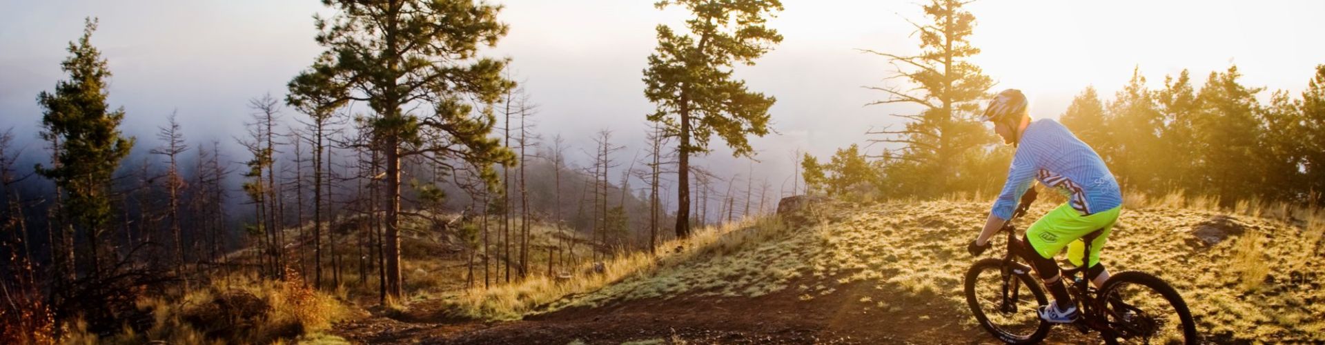
The Rose Valley Trail system is popular for hiking and biking.
Distance/Duration: 6 km (round trip)/2-4 hours
Elevation Gain: 80 metres
Difficulty Level: moderate to difficult
GPS: 49.884459, -119.560079
Access Points: There is a parking lot on Westlake Road right across from the Firehall, near Rose Valley Elementary School. You can also find an additional parking lot that has a biking cleaning station at the corner of Rosewood Dr and Rosewood Lane.
About this Trail: Rose Valley Regional Park has an extensive hiking and biking trail network that is marked by usage rather than signage. It is recommended for the moderately fit as there are some steep climbs and one should be aware there are some sudden steep drop-offs.
Users should be aware that this is not a looped trail, so they will need to retrace their steps. Hikers will be rewarded with panoramic views, wildlife sightings and volcanic cliffs marked by caves that are believed to have been created by large air bubbles in the lava. There are plateaus of grassland, wooded areas and steep cliffs. For mountain bikers, there are no stunts in the regional park, but the ride rewards you with amazing views.
CAUTION: These trails are shared by hikers and mountain bikers. Take care to avoid contaminating the Rose Valley Reservoir – it is an important source of public water supply.
Features: volcanic cliffs, caves, flora & fauna, grassland plateau, panoramic views, Goldies Pond, man-made reservoir, bird watching, wildlife
Rose Valley Hiking Trails Trailhead Map | GPS-enabled Map for Rose Valley Regional Park
Learn more about GPS-enabled maps here.