Arrowleaf Balsamroot Flower (smukʷaʔxn)
A true sign of spring in the Okanagan is the emergence of the Arrowleaf Balsamroot flowers (Balsamorhiza sagittata), also known as the Okanagan Sunflower. Their brilliant yellow colour is spectacular particularly when seeing an entire hillside adorned...
Tips for spring hiking.
Warmer temperatures are just around the corner. With the warm weather comes wet trails and ticks at this time of year.
When a trail has snow on it we are prepared that it may be slippery, but...
The Rose Valley trails within Rose Valley Regional Park are considered one of the hidden gems in the Okanagan. The hike samples many of the brilliant features the region has to offer, such as hiking through a forest, surrounded by...
Smith Creek Trails
Duration/Distance: 15 km (various routes) /1-4 hours
Elevation Gain: 400-700 metres (depending on route taken)
Difficulty Level: moderate
Access Points: From Hwy 97 follow Elliott Road to Smith Creek Road. Turn right onto Smith Creek and follow it up. The road...
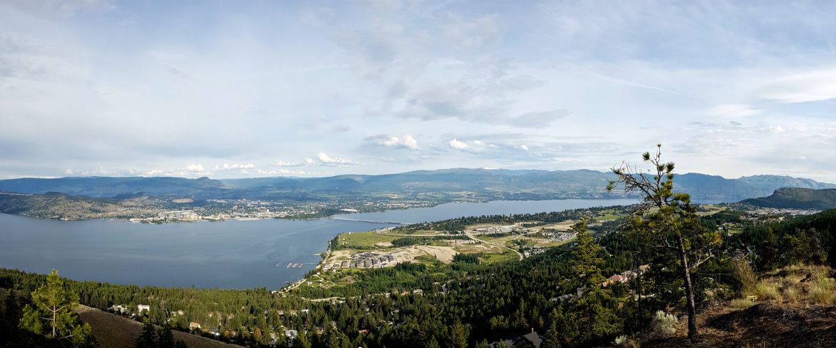
GLEN CANYON REGIONAL PARK (NORTH)
Distance/Duration: various routes; over 4 km/2 hours or less
Elevation Gain: 70 metres
Difficulty Level: moderate to difficult
GPS: 49.835192, -119.647489 or 49.848037, -119.663503
Access Points: The Aberdeen Trailhead can be found at Aberdeen & Webber Roads. Go to the...
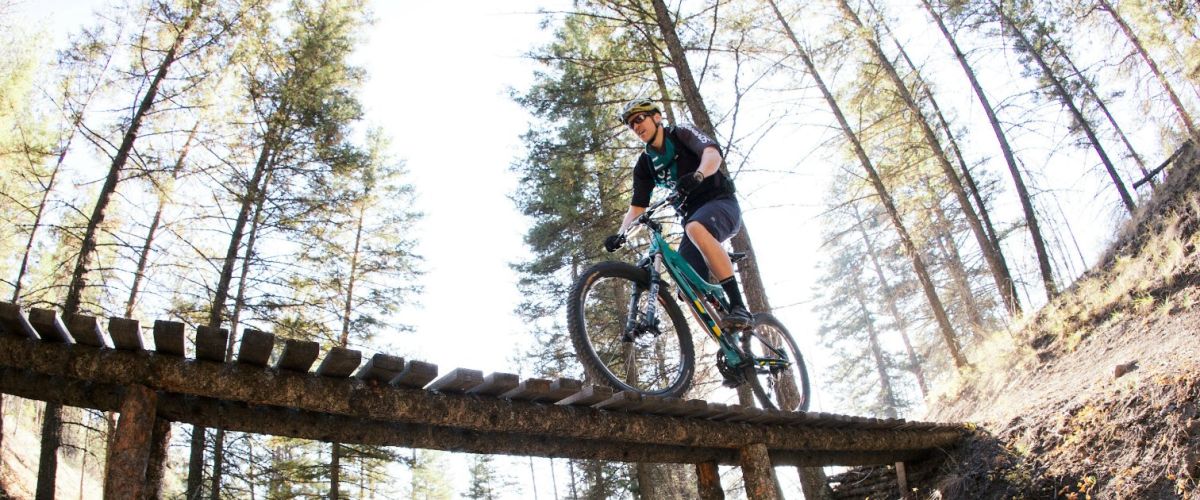
ROTARY TRAILS
Distance/Duration: 1 km/1 hour or less
Elevation Gain: minimal
Difficulty Level: easy to moderate (a few stairs)
GPS: 49.815579, -119.623165
Access Points: Gellatly Road, across from the Westbank Yacht Club.
About this Trail: You will find a network of trails and bridges that follow...
GLEN CANYON REGIONAL PARK (SOUTH)
Distance/Duration: 2.2 km one way/2.25 hours for the Glen Canyon Green Way Trail
Elevation Gain: 80 metres
Difficulty Level: moderate (stairs)
GPS: 49.825429, -119.642256 or 49.827054, -119.636830
Access Points: Three access points: The main parking area at the south end of...
SHANNON LAKE REGIONAL PARK
Distance/Duration: 2 km round trip/1 hour or less
Elevation Gain: 0 metres
Difficulty Level: easy
GPS: 49.855102, -119.617646
Access Points: Parking lot off of Shannon Lake Road
About this Hike: This is perfect for a leisurely stroll as there are wide flat...
TELEMARK TRAILS
Distance/Duration: various routes; 0.5 km – 15 km depending on trails chosen/1-6 hours
Elevation Gain: 0 – 200 m depending on trail
Difficulty Level: easy to difficult – depending on trail
GPS: 49.862117, -119.71033
Access Points: 9 km from Hwy 97 along Glenrosa...
POWERS CREEK MOUNTAIN BIKE TRAILS
Duration/Distance: various routes; 2 to 8 km
Elevation Gain: up to 600 metres
Difficulty Level: difficult
Access Points: From Hwy 97 turn onto Glenrosa Road. This is the same road that heads out towards Crystal Mountain. You will pass...

Recent Comments