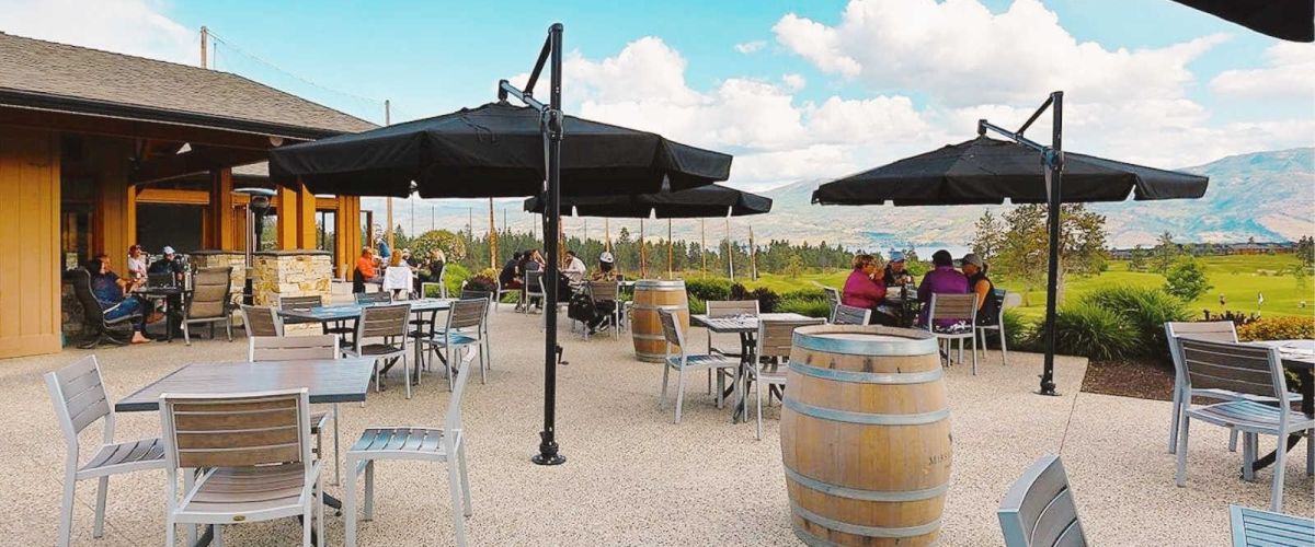
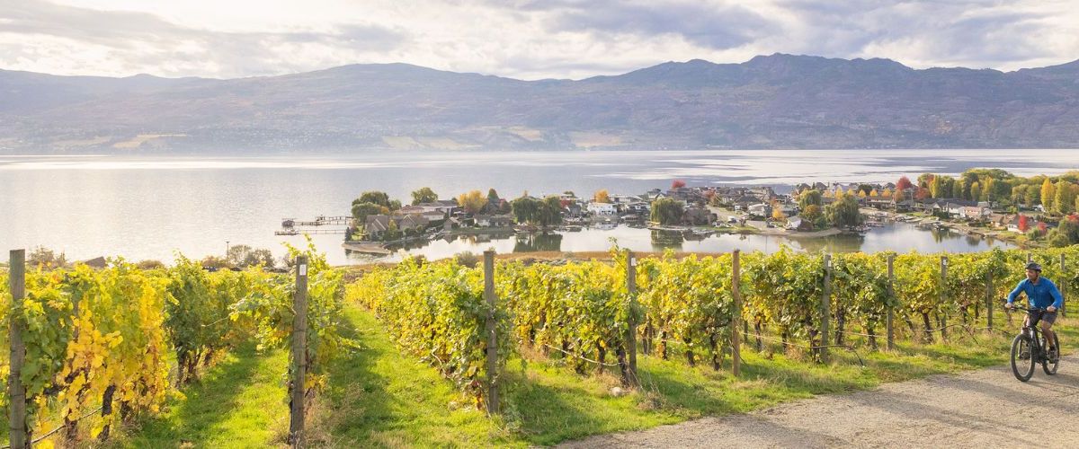
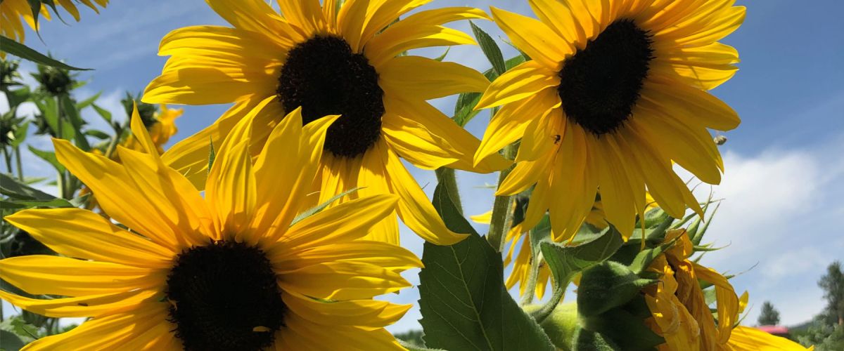
It is Patio Season!
Soak up the sunshine and sip in the scenery - patio season has officially arrived in West Kelowna.
Whether you're craving a cozy spot on a bustling street or a serene table overlooking the vines, West Kelowna offers...
Dog-Friendly Beaches and Parks in West Kelowna
Travelling with your four-legged friend this summer? Check out some of West Kelowna’s dog-friendly parks and trails! A majority of West Kelowna parks and trails allow dogs on-leash, while there are 3 off-leash dog...
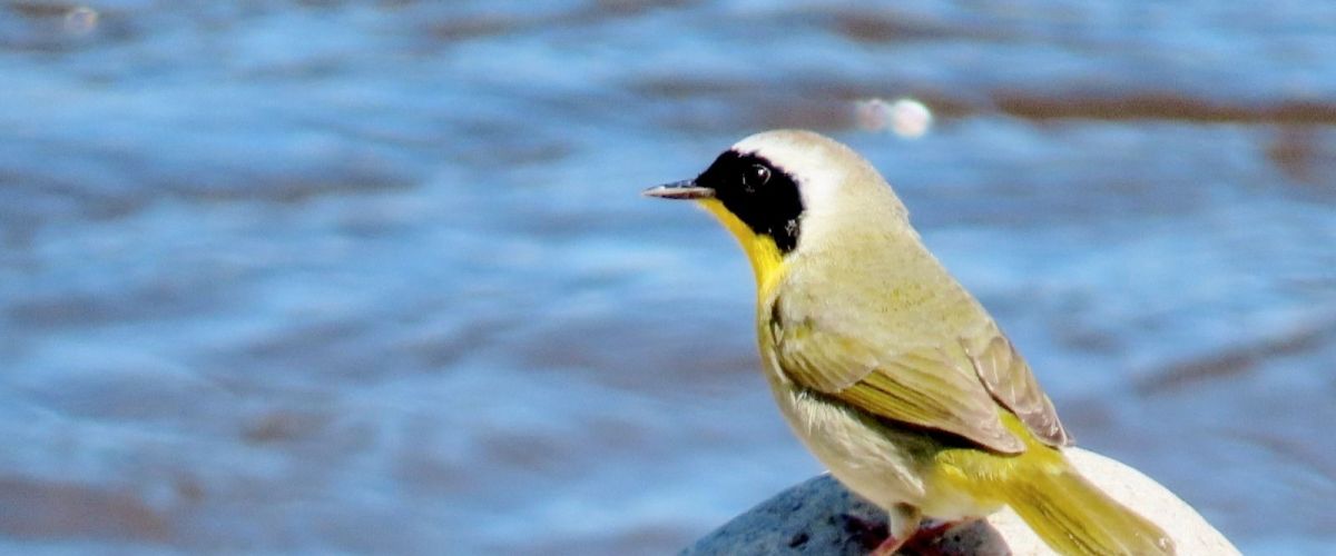
Bird Watching: How to get started.
(photo: Brad Vissia - Common Yellowthroat)
Have you ever wondered what that bird was that you saw out on a walk? If so, you are not alone. With people enjoying wide-open spaces and nature more this...
KALAMOIR REGIONAL PARK
(July 3, 2026 update - visitors can once again access the southern portion of the park via the main entrance at Collens Hill Road. This reopened area includes Sunnyside Trail as well as access to Bowser Beach, the...
Kalamoir Regional Park in West Kelowna
(July 3, 2026 update - visitors can once again access the southern portion of the park via the main entrance at Collens Hill Road. This reopened area includes Sunnyside Trail as well as access to...
June is National Indigenous History Month in Canada, a time to recognize, celebrate, and learn about the rich cultures, traditions, histories, and contributions of First Nations, Inuit, and Métis Peoples. Here on the Westside, visitors and residents have unique opportunities...
Mother’s Day 2026 moments to enjoy together in West Kelowna including hiking, wine tasting, brunch and other waterfront activities:
If Mother’s Day calls for more than flowers and a card, West Kelowna can certainly promise an experiential weekend of vineyards, artisanal...
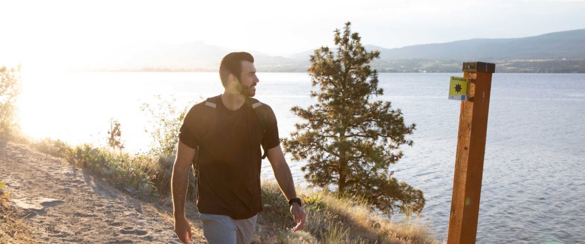
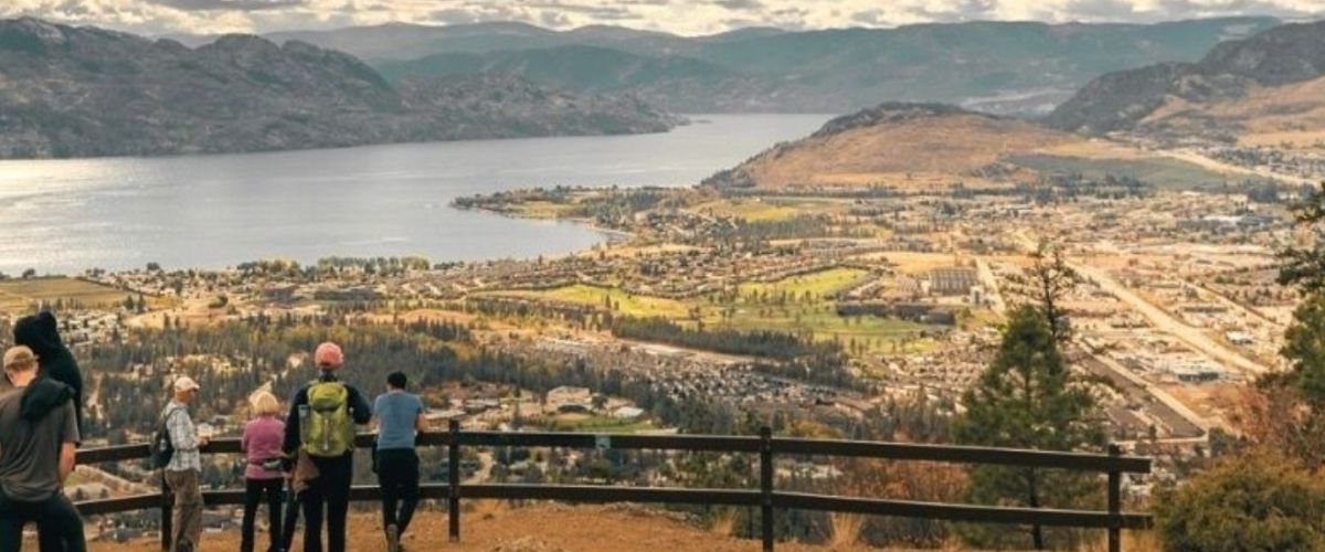
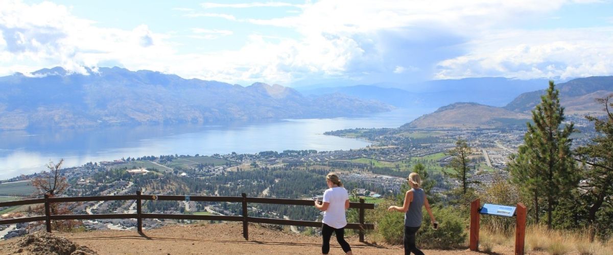
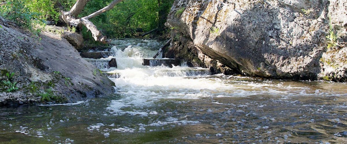
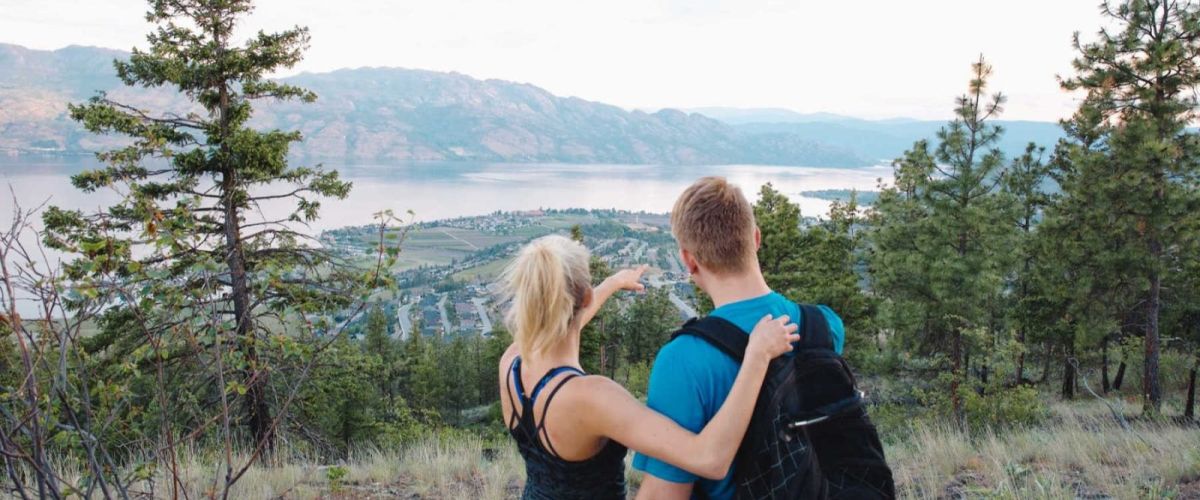
The Top Spring Hikes in West Kelowna
West Kelowna has a pretty strong hiking game when it comes to our trails. From hillside treks and fields of flowers to waterfalls and stunning panoramic views, our trails are easily accessible from our...
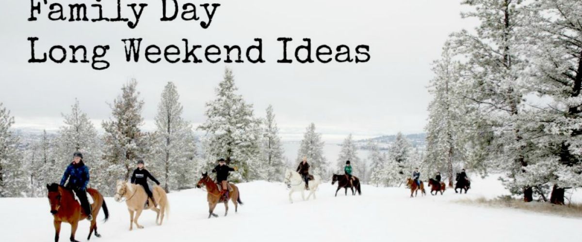
Looking for inspiration this BC Family Day weekend? We have curated a list of local experiences that make it easy to get out, explore, and spend time together. From community events and scenic trails to sweet café stops, these...
With Valentine's Day around the corner, it is time to solidify those weekend plans! From romantic weekend getaways and curated experiences to dining and special sip boxes, romance appears to be in full swing in West Kelowna.
Whether you decided to...
Get Ready to Taste Around the Okanagan!
Dine Around has a fresh new name – Taste Around! – and it's back in the Okanagan from January 21 - February 8, 2026. This is a great chance to discover the culinary scene...
You know that feeling when you can’t decide what to eat? Should you go out or do take out? Are there any new restaurants to try? You know the questions and we have some answers. We are here to help...
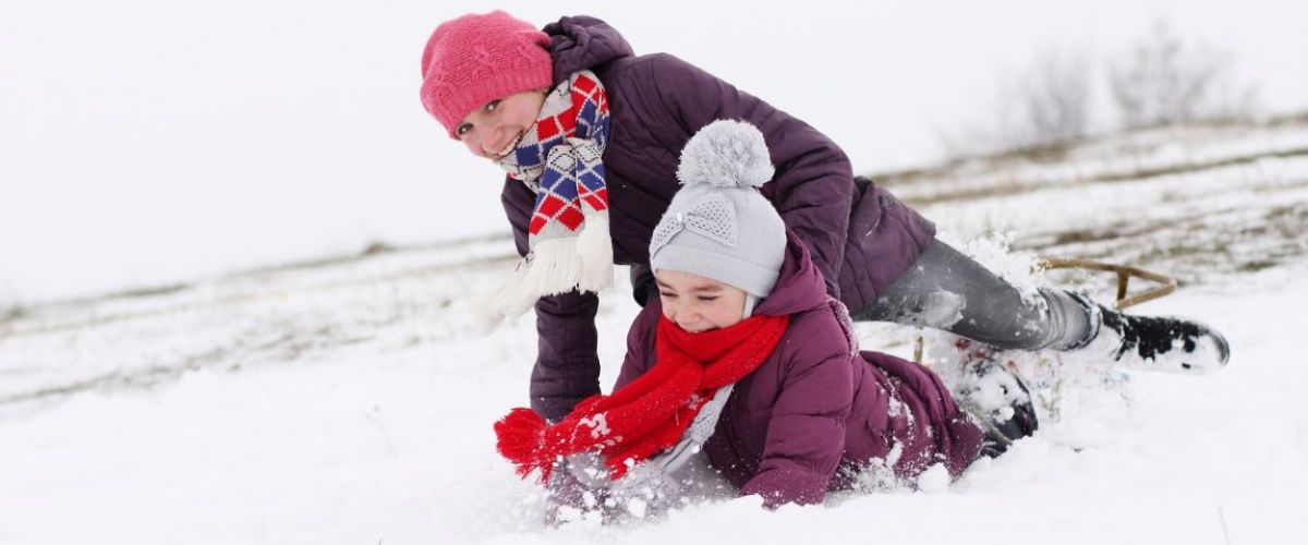
Let's Winter! Here are our picks for winter break activities in West Kelowna!
Winter fun is heating up for people of all ages in West Kelowna. Here, when the snowflakes begin to appear, the outdoor enthusiasts start to cheer! Our powered-filled...
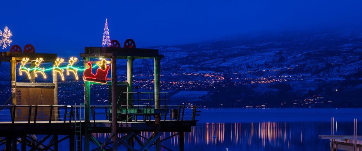
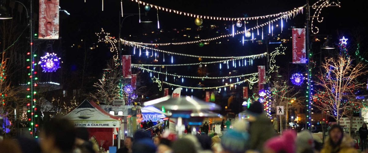
2025 Holiday Light Displays
Christmas holiday light displays are magical and can cheer up even the crankiest of scrooges. The Westside has some pretty spectacular light displays that are sure to dazzle and amaze.
Below is a link to the 2025 Self-Guided...
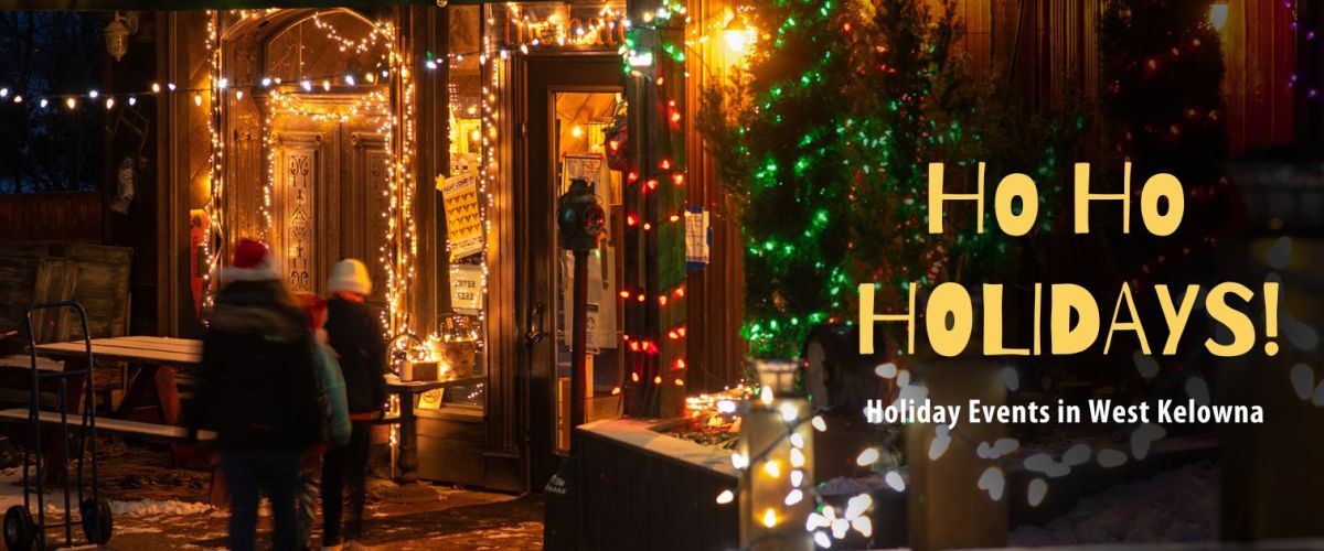
2025 Ho Ho Holidays Event Guide
It’s time to get festive! There are some great holiday events taking place in West Kelowna over the coming weeks. Use this handy Ho Ho Holidays Event Guide and make the most of this holiday...
Our West Kelowna businesses and community organizations have gotten creative and are ready to treat you to some spooky delights. Here is a list of Halloween events for 2025 and be sure to check back as it is continually being...
Fall for West Kelowna: Your Ultimate Thanksgiving Long Weekend Itinerary
The air is crisp, the leaves are turning, and the scent of pumpkin spice is everywhere, it's the Thanksgiving long weekend! Whether you're hosting a houseful of guests, seeking a relaxing...
Yeehaw, West Kelowna! The city is buzzing with excitement as we get ready to celebrate Country Music Week!
While the Canadian Country Music Awards (CCMAs) show might be happening in Kelowna, we're bringing the party to West Kelowna with a whole...
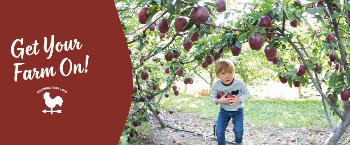
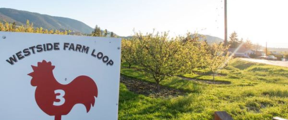
Discover Farm-Fresh Fun in West Kelowna: Visit the Farm Loop
Don't miss the chance to explore the Westside Farm Loop in West Kelowna this fall! This picturesque route is a hit with families and nature enthusiasts, offering a charming blend of...
Your West Kelowna adventure starts here! This summer, we’re inviting you to explore, taste and experience all the fun our community has to offer with our Summer Adventure Bingo card.
It’s easy to play:
Pick up your Summer Adventure Bingo Card at...
Unique Stops & Scenic Eats
Craving a taste adventure? West Kelowna’s food truck scene offers a delicious way to explore local flavours. From mouthwatering gourmet hot dogs and sweet treats to poutines and pizzas, these mobile kitchens dish up a great...
Top Beaches in West Kelowna, including Spray Parks, Parks, and Pools
The summer heat is here with temperatures reaching the high 20’s and low 30’s. We love our Okanagan heat, but what we also love are ways to cool down and...
Whether you are chasing adrenaline, craving calm or looking to dive into local culture, we have you covered. From outdoor adventures to leisurely escapes, there's something for everyone. Check out this curated list of ideas to spark your long weekend...
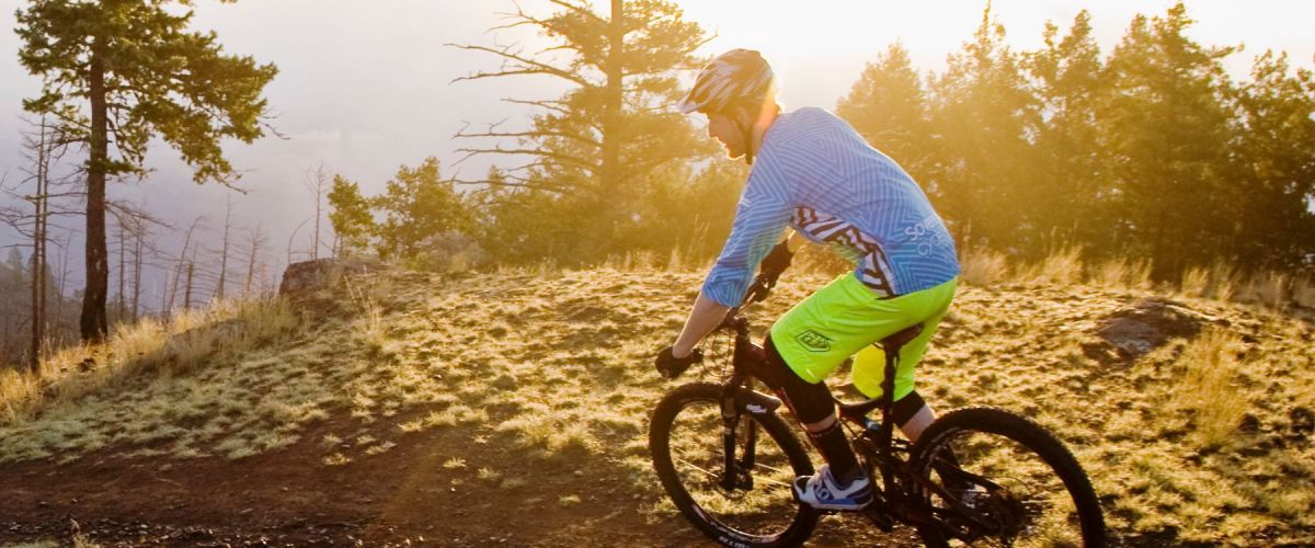
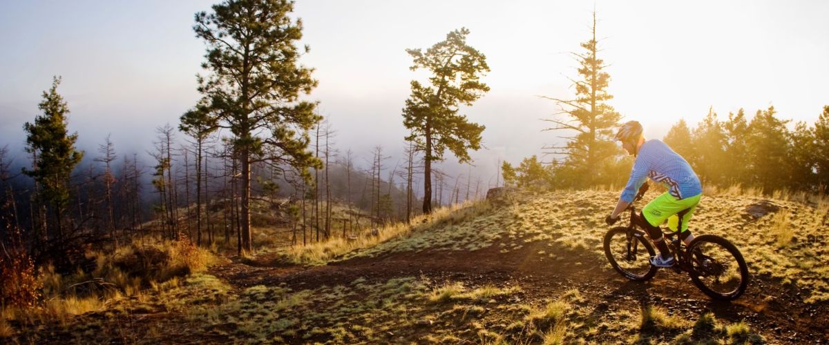
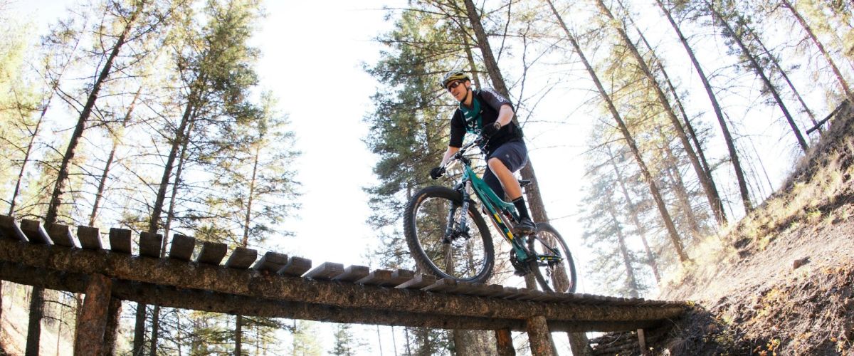
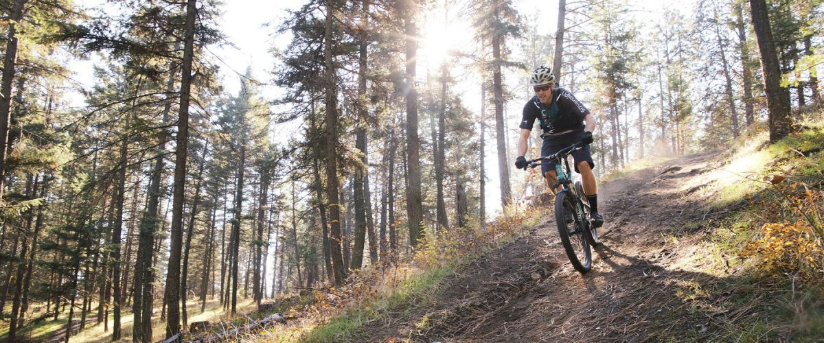
Discover West Kelowna's Smith Creek Trail Network, where adrenaline-pumping descents meet breathtaking Okanagan vistas. The Smith Creek Trail Network is a seven-minute drive from the town centre and a 20-minute drive from downtown Kelowna. It is a hidden gem for...
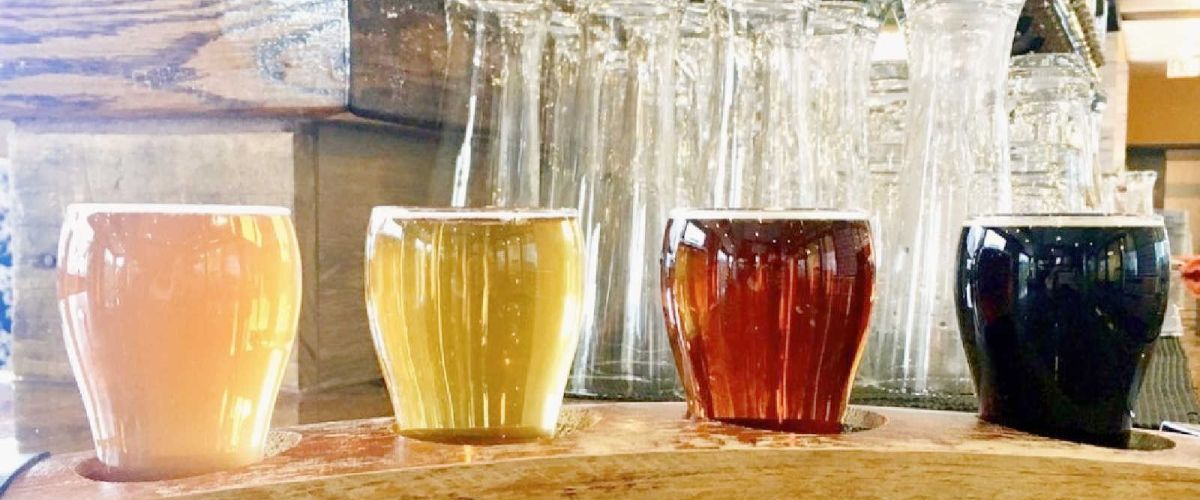
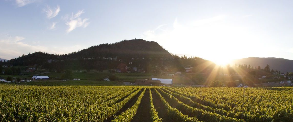
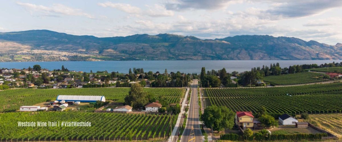
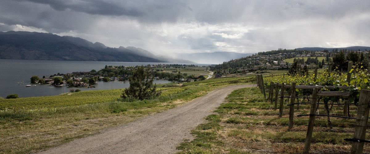
The Wineries, Breweries, Cideries, and Distilleries of West Kelowna
A fascinating blend of experiences can be had when visiting the tasting rooms of our wineries, breweries, cideries and distilleries.
West Kelowna is known for gorgeous landscapes, fantastic trails, and rolling hills of...
Here are some great options for spring break adventures in West Kelowna. Whether you're looking for outdoor thrills, cultural experiences or relaxation, West Kelowna has a perfect mix of activities and experiences for a fun-filled spring break.
1. Learn about the...
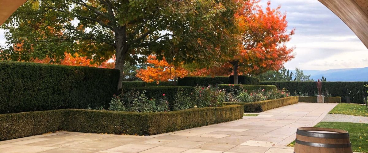
Fall Foliage in West Kelowna - a photo collection
Nature lovers can enjoy spectacular views this time of year with all the beautiful fall colours on display. Our Instagram feed has been blowing up with the fall foliage and we thought...
West Kelowna's Craft Breweries
West Kelowna is known for gorgeous landscapes, fantastic trails and rolling hills of vineyards with wineries, but did you know that we now have some craft breweries worth raising a glass to? We have a few great...
Welcome the coziness of autumn with our list of fall events and activities. (updated for 2025)
We’re talking about sunrise hikes, biking, bird watching, fall markets, brewery events, wine harvest, apple picking, pumpkins and learning about the history of the syilx/Okanagan...
Explore West Kelowna's Beauty on the Boucherie Multi-Use Path/Recreation Corridor
The Boucherie Multi-Use Path/Recreation Corridor is a scenic 4.8 km route that welcomes cyclists and pedestrians. This paved, off-street path offers more than just exercise; it's your gateway to West Kelowna's...
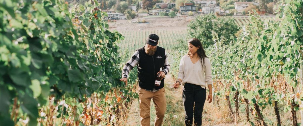
Explore the Wineries of West Kelowna: Adventure Awaits!
Discover the beauty of West Kelowna's wine country with its stunning views, sprawling vineyards, and exceptional wines. But, did you know that there is much more to this charming destination than just wine...
Each June, Pride Month stands as a vibrant testament to the beauty of diversity and the resilience of the LGBTQ+ community. This year, the Central Okanagan joins in with a week-long celebration of Pride. Embrace inclusion and diversity by supporting...
Rainy Day Fun in West Kelowna!
West Kelowna is known for sunshine and stunning Okanagan views, but even paradise gets a sprinkle sometimes! Don't let the rain dampen your Okanagan experience as our hospitality shines through regardless.
We have a list of...
From art exhibitions and museums to self-guided tours and live performances, West Kelowna's cultural scene offers a symphony of colours, stories, and talents.
Here’s your guide to the art events and activities happening in West Kelowna this October.
Cabernet & Clay Workshop...
What's Happening in West Kelowna | May Events
May is a great month for outdoor activities and festivities, and this year is no exception. There are several upcoming events and programs that are sure to satisfy your need for adventure, fun...
Things to do this February 2023 in West Kelowna
February may be the shortest month of the year, but there is no shortage of fun events and activities to do!
From winery events and hockey games to outdoor treks and live entertainment,...
Light Up will take place on December 2nd on Brown Rd.
Light Up in West Kelowna will take place on Friday, December 2nd from 5:00pm to 8:00pm with a special Fireworks Show at 8:30pm.
Fun activity stations will include favourites like the...
Things to do in West Kelowna with Kids
Do you have a toddler in your life and are looking for places to go and things to do? Look no further as we have some great ideas for you and your toddler!
Let...
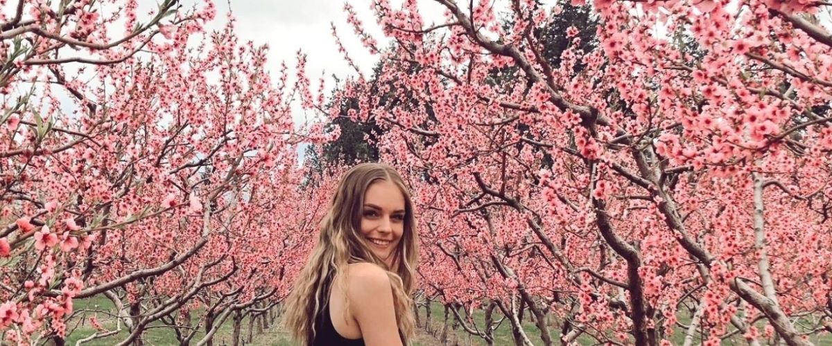
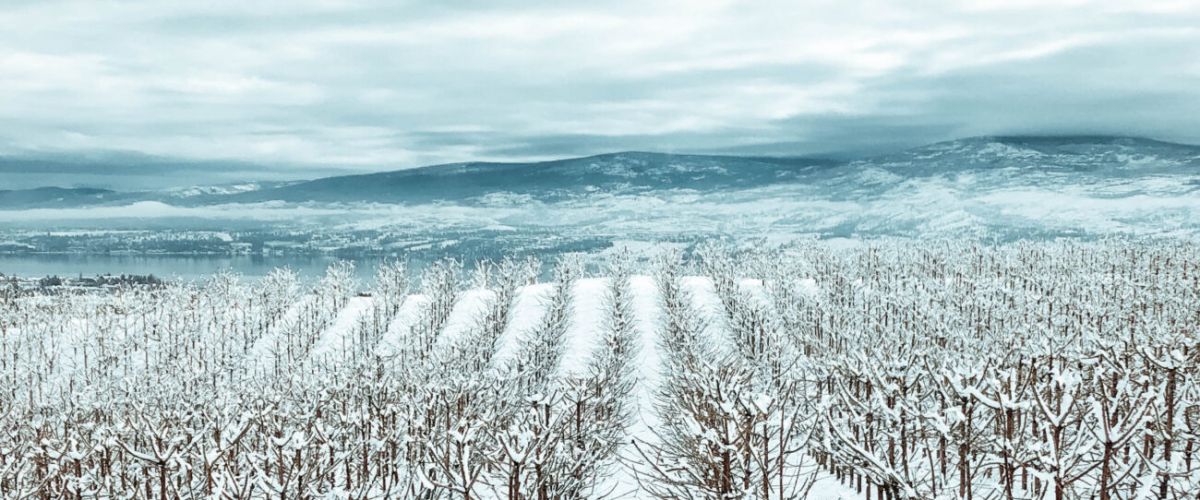
Spring Blossoms and Blooms!
Springtime in West Kelowna is just around the corner and that means our hillsides and orchards will be putting on a spectacular display of colour. In March our first wildflowers begin to show, but April is the...
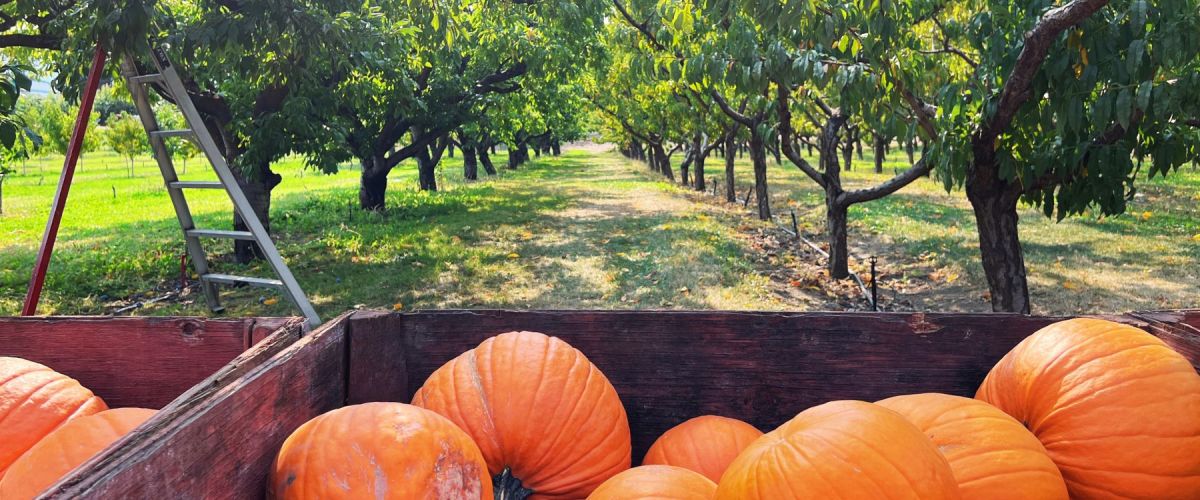
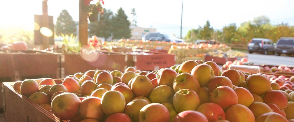
Harvest and apple picking in West Kelowna
Fall is a favourite season for many. With the crisp fresh air, changing colours, and fall harvest is there really anything better? Visiting an orchard to pick apples or stopping by a fruit stand...
If you are looking for indoor happenings to escape from the elements (rain, smoke, heat, etc), West Kelowna and the Greater Westside have several attractions and activities to keep you busy!
Before heading out to these places, a friendly reminder that...
The Westside Wine Trail is conducting a survey regarding wine tourism in our region and would love your help!
Those that complete the survey by June 30th, 2021 will have an opportunity to enter a draw for a Westside Wine Trail...
We have five ideas of things for you to do this Easter long weekend.
Community Easter Egg Hunt
Potter’s Community Church is hosting a safe Easter Egg Hunt Contest. Between April 2-5, find a Potter’s House Easter Egg Sign or Poster, snap...
What do newcomers think the top 5 things to do in West Kelowna are?
Have you ever wondered what visitors or new residents think about our community? One newcomer grabbed her camera, went exploring and this is what she captured.
Let us...
Getaway to West Kelowna with some Staycation and Sweetheart Deals
Going on a getaway doesn’t mean you have to travel far – some of the best getaways are the ones that are close to home. There are so many benefits to...
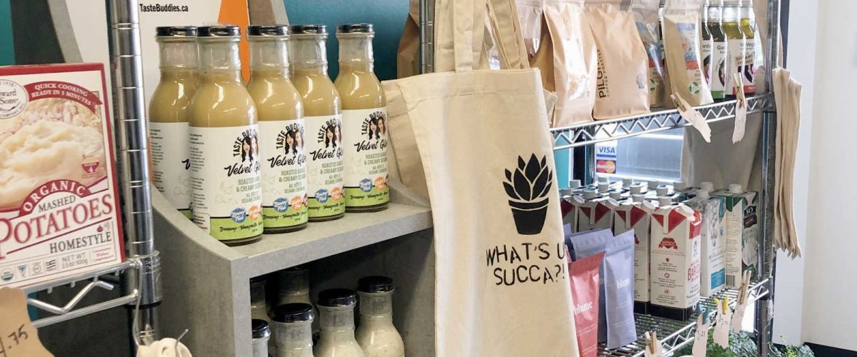
Specialty Food Stores in West Kelowna
West Kelowna is home to several specialty food stores where you can easily satisfy your food cravings. Vegans will be thrilled with the planted-based food market and foodies will be able to find specialty vinegar,...
Warm-up this winter with these Winter Wine Experiences
Fireside sips. Dining under a dome. Snow and sips. Icewine Gala. These are just a few of the new winter wine experiences our wineries are offering this season. We invited you to take...
What's on your Wishlist? A West Kelowna Holiday Gift Guide
This year it is more important than ever to support the local businesses that we love, so why not give the gift of the Okanagan? We have so many great businesses...
With physical distancing happening, more and more people are turning to Zoom to conduct their meetings. Did you know that in Zoom you can add a custom background to your video conferences?
Changing your background is perfect for those who don’t want...
With the weekend upon us and most of those home improvement projects completed, it’s time to start getting out to explore our own backyard and #supportlocal. To help you out, we’ve curated three delicious ideas to check out this weekend...
Looking at or listening to the sounds of nature can create a sense of calm and make one feel relaxed. We are digging into our library to create some looped nature videos for you that focus on the sights and...
Sip and Paint parties seem to be pretty popular right now. For those who have not heard of them, the idea is that local restaurants usually provide a venue space, and people to all paint the same photo while enjoying...
There is no doubt about it, this spring break is unlike one that we have ever experienced. Many of you had to cancel your travel plans and opt for a staycation.
Even a Staycation is looking different than in previous years, as everyone is...
Get out and check out some of these February events and activities
February is an endless cycle of ‘winter is here… oh wait spring is around the corner, hmm – snowstorm again… ahh – the sun is out, it’s almost springtime!’...
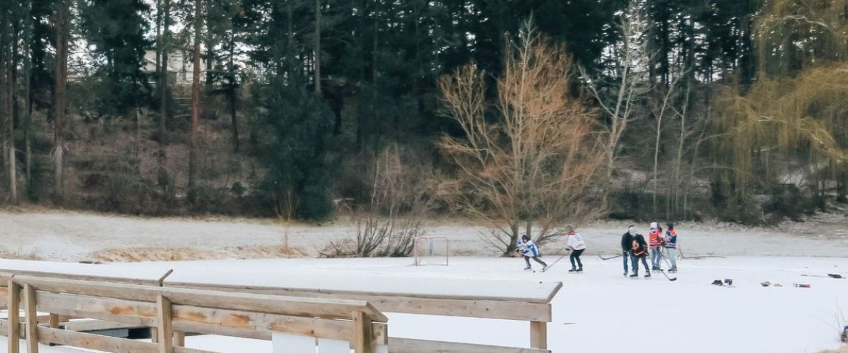
From action on the ice to the trails in the mountains, tons of fun can be found during the winter months in West Kelowna. The powder filled valleys and mountains beckon x-country skiers and snowshoers to come out and play,...
BOUCHERIE RUSH TRAIL - West Kelowna Hiking
Duration/Distance: 6 km round trip/1-3 hours
Elevation Gain: 275 metres
Difficulty Level: moderate to difficult
Access Points: From Hwy 97 turn South onto Bartley Rd. This road turns into East Boundary Rd. Follow the road approximately 1.5 km...
Something spooky has been happening at the Westbank Museum!
It was a dark and stormy night… How else would one begin a ghost story? For the Westbank Museum, it started a little differently. It began with a visitor. Kay wandered into...
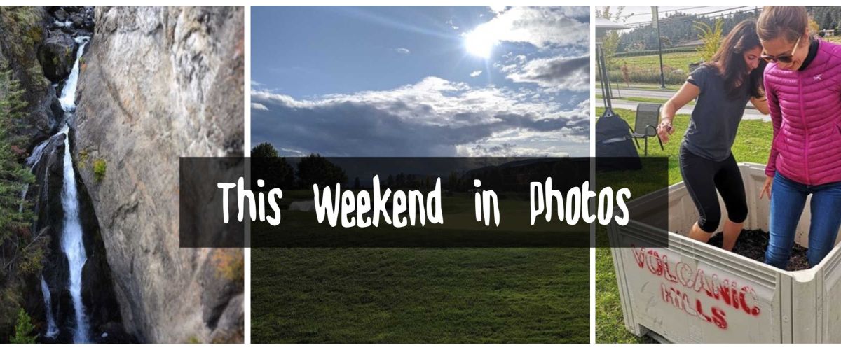
Round-up of Photos
It is a kaleidoscope of colour out there and we love seeing your weekend views! Our waterfront, trails and vineyards continue to be popular this time of year.
Scroll down and take a peek what was happening this...
Hello October!
The first week of October has passed us by and it looks like people got out and enjoyed what West Kelowna has to offer. It is great to see that people have been enjoying our trails (looks like...
The Westside has great transit and bike paths, allowing access to many of our attractions without the use of a car. Whether you’re looking to save gas money, be more environmentally friendly, try some wine tastings without worrying about a...
ROSE VALLEY REGIONAL PARK IS CLOSED (pending assessments for safety and hazards)
ROSE VALLEY REGIONAL PARK | Hiking and Biking Trails
The Rose Valley Trail system is popular for hiking and biking.
Distance/Duration: 6 km (round trip)/2-4 hours
Elevation Gain: 80 metres
Difficulty Level: moderate...
Upick flowers and fruit.
Westbank Corner Fruit Stall is the fourth stop on the Westside Farm Loop, and is family owned and operated since 1919! They are located on the corner of Elliott Rd and Solar Rd. This is in close proximity...
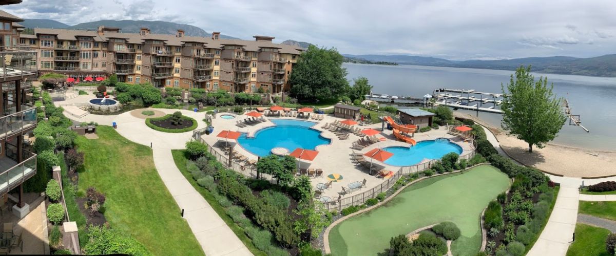
An Afternoon at the Cove Lakeside Resort: Lakeside Fun for Locals and Visitors Alike!
Staff from the Westbank Museum and West Kelowna Visitor Centre recently visited The Cove Lakeside Resort for a familiarization tour. This picturesque resort is located on the...
It was wine o’clock somewhere along the Westside Wine Trail this past week! With 14 tasting rooms to explore there was a lot to experience and take in. From hugging goats and poising in front of old trucks to discovering...
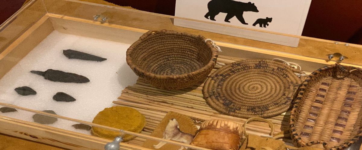
Staff from the Westbank Museum and Visitor Centre recently visited the Sncewips Heritage Museum on a familiarization tour. This museum opened in 2014, and has various displays that showcase the living history of the Okanagan nation. Sncewips offers a variety...
Spectacular Fall Colours in West Kelowna as seen on Instagram
If you thought that the fall colours are more spectacular this year, you are probably right. Byland’s Nursery recently linked to an article on their Twitter account that talked about why...
Okanagan Fall Wine Festival
The annual Fall Okanagan Wine Festival returns for a 38th year – wow! Our wine trail has changed quite a bit from those first years, namely with the number of wineries we now have. Currently, we have...
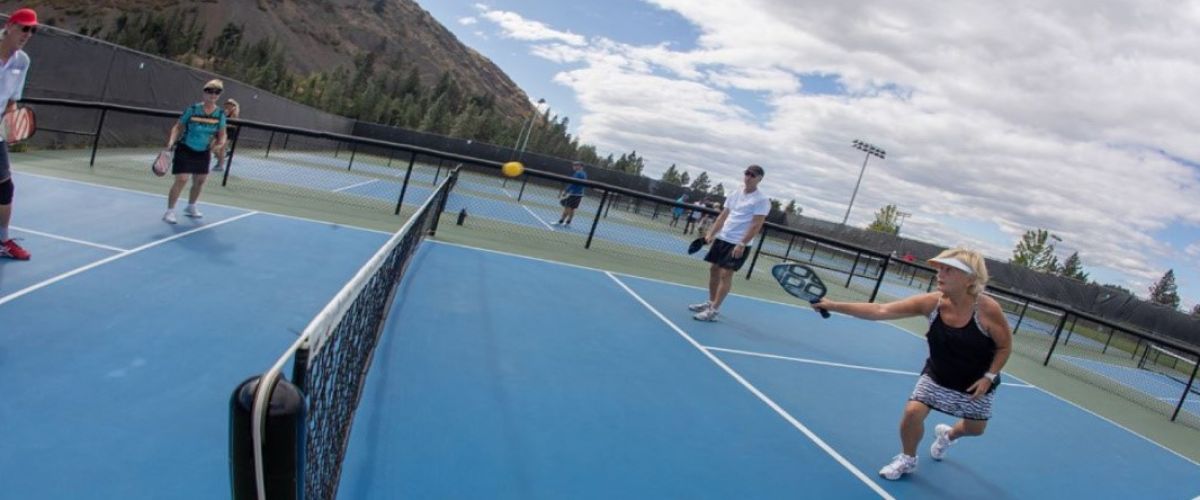
Learning about pickleball while attending the Super Seniors Pickleball Tournament
Recently, I had the opportunity to work at a mobile Visitor’s Centre at the Super Seniors Pickleball Tournament, hosted by the newly formed West Kelowna Pickleball Club. Held at the Mount...
Things for teens to do this summer.
Is your teen restless and look for things to do this summer? Look no further! Here's some ideas to keep them entertained.
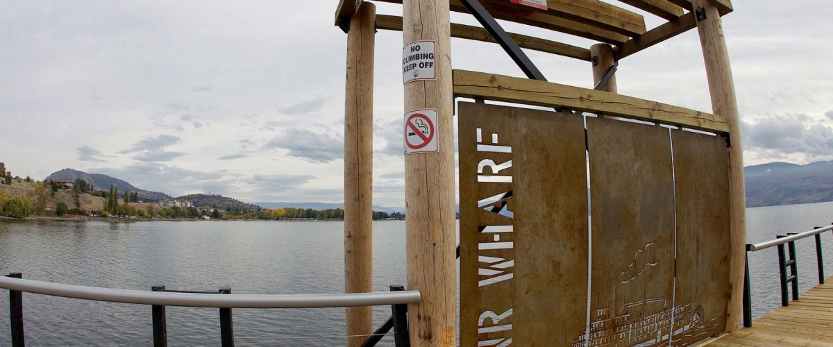
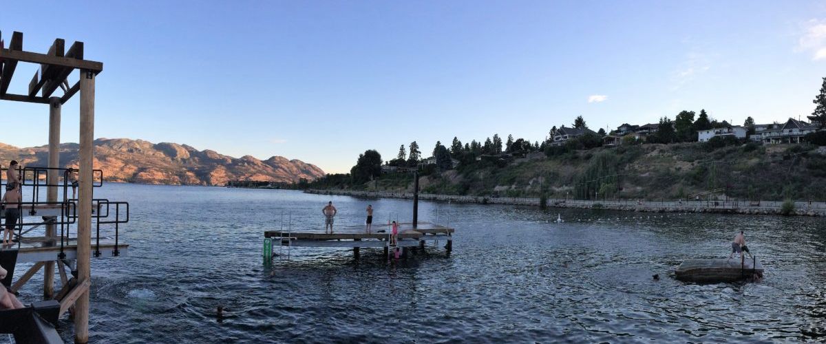
Make a Splash at CNR Wharf | 4030 Gellatly Rd
Soak up the sun...
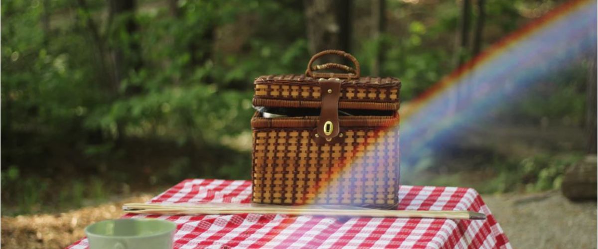
Where to get Items for Your Picnic or BBQ
With summer in full swing and the hot sun beaming down, a picnic at a local beach or a backyard BBQ is a great way to spend the afternoon with friends and...
The latest Fresh Sheet is here. Find out what is happening in West Kelowna and on the Westside of Lake Okanagan.
For more information on any of these events and activities visit the events section of our website at www.visitwestside.com/events or give...
Ice Cream and Iced Drinks
With the average Okanagan highs reaching 28˚C during July and August, it’s important to cool off after a day filled with hiking, wine touring, or fruit picking. Check out some of the best places on the...
Seasonal Bus Service
The City of West Kelowna recently announced a new seasonal bus service that will connect Westbank Centre with the Gellatly Bay Waterfront area. See the full press release below.
FOR IMMEDIATE RELEASE
June 26, 2018
A new seasonal bus route to...
Farmers' Market in the heart of Westbank Centre in West Kelowna
The Westbank Farmer's Market may be small, but don’t let its size fool you! One can still get great farm fresh fruits and veggies, along with preserves, baking, and artisanal crafts...
[caption id="attachment_5172" align="aligncenter" width="1024"] photo: Westside Daze[/caption]
Westside Daze, West Kelowna's local fair!
The biggest event on the Westside is coming in a few weeks and the organizers of Westside Daze promise that it will be loaded with entertainment for all ages....
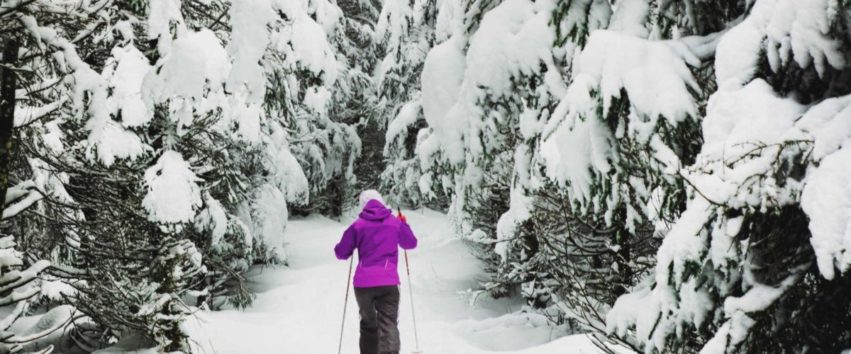
It is the Family Day long weekend and we have some ideas to keep you busy all weekend long!
Trail Photo by Darren Hull
Hit the Trails
Discover the magical winter wonderland of our forests by trail. Ski, snowshow, ride or walk these...
Do the winter blues have you down? If so, it is then time to break out of the usual routine and embrace the flakes with a sip and snow weekend.
We have five ideas of how you can enjoy a winter...
Cross country skiing is a great way to spend the afternoon burning off some of that pent up winter energy and it’s an activity that all ages can enjoy. Families with grandparents and grandchildren can often been seen out on...
It is a new year, which means it is a time for reflection. We thought we would take a closer look at went on with our Instagrammers this past year. We check out what people were tagging us in, what...
First Snowfall of 2017
When looking outside, it is really hard to believe that it is the beginning of November! Here in the Okanagan, we are used to spending this time of month, traipsing through piles of leaves, exploring a few...
Fall is a perfect time to hit the trails and do some hiking or biking. From what we have been seeing, a lot of people have been enjoying our trails and the fall colours. Here are just a few of...
5 things to do this long weekend.
The mornings are crisp and the afternoons warm, coming up is the first long weekend since the kids went back to school. This weekend is a busy weekend as students return home from university...
Here are just a few photos from this past weekend that we spotted with the #VisitWestside hashtag or @Visitwestside tag.
Nothing like a good sunset to end the weekend.
https://www.instagram.com/p/BXt__b8gHux/
Yoga. Music. Sunset…. We are seeing a theme of sunsets here….
https://www.instagram.com/p/BXvYcGYlN8R/
What’SUP
https://www.instagram.com/p/BXwjWVcFQjk/
Pop up Dinner...
We spotted the #VisitWestside hashtag!
People have been respecting the trail closures and have been heading to the water, wineries and farmers' markets. Here are just a few photos from this past long weekend that we spotted with the #VisitWestside hashtag...
Each Monday we like to post a few photos of what people were up to this past weekend. It looks like people headed to the markets for cherries and the wineries for summer sippers and great views rather than the...
Arrowleaf Balsamroot Flower (smukʷaʔxn)
A true sign of spring in the Okanagan is the emergence of the Arrowleaf Balsamroot flowers (Balsamorhiza sagittata), also known as the Okanagan Sunflower. Their brilliant yellow colour is spectacular particularly when seeing an entire hillside adorned...
Tips for spring hiking.
Warmer temperatures are just around the corner. With the warm weather comes wet trails and ticks at this time of year.
When a trail has snow on it we are prepared that it may be slippery, but...
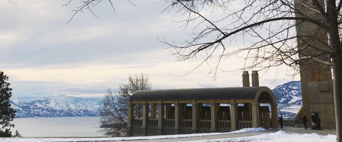
7 Beautiful Winter Scenes of West Kelowna
In West Kelowna and throughout the Okanagan, images of sun soaked beaches, glistening waters, lush rolling hills of vineyards and ripe orchards are what come to mind. When the snow hits the area becomes...
Large urban centres like Vancouver and Victoria abound with art galleries on well travelled downtown streets. They make up part of the centre of swanky cultural districts. While there are art galleries of this type in the Okanagan, they are...
Food Trucks
What do you get when you put 9 food trucks, a boutique clothing retail bus (yes, it was literally a store in an old school bus), a booth about a hotel that “rebels against the ordinary”, a stand littered...
Tucked away on Paynter Road is a rural hideaway of culinary delights called Rabbit Hollow, the home base for The Chef InStead. From the front, a cute but otherwise unassuming home is all one might see. The only clue that...
I decided I needed a little pampering so I booked my first visit to the Ten Spot where I treated myself to mani & pedi. Upon arrival I first noticed how fresh and clean the beauty bar and was offered...
There is no doubt, West Kelowna has some pretty stunning vantage points, our Instagram feed can attest to it on a daily basis. We also have some interesting architecture, pieces of history and quirky items that people like to photograph.
We...
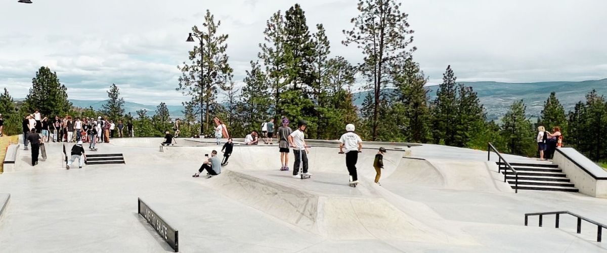
Have you ever heard the saying "you never really grow up”? Well it certainly is true when it comes to playgrounds. The Johnson-Bentley Memorial Aquatic Centre recently upgraded the skate park and put in a new playground and it was...
It’s safe to say that we here at the West Kelowna Visitor Centre enjoy a good lunch spot. One of the things we love about our job is that we can explore and experience local eats and then encourage visitors...
The Rose Valley trails within Rose Valley Regional Park are considered one of the hidden gems in the Okanagan. The hike samples many of the brilliant features the region has to offer, such as hiking through a forest, surrounded by...
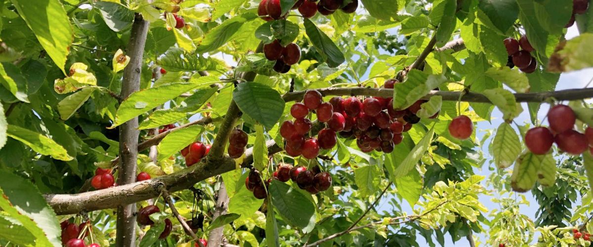
Each summer the Visitor Centres in the Okanagan are flooded with requests for places to pick cherries. It is a great activity that all ages can enjoy. Several farms along the Westside Farm Loop offer upick cherries, and if you...
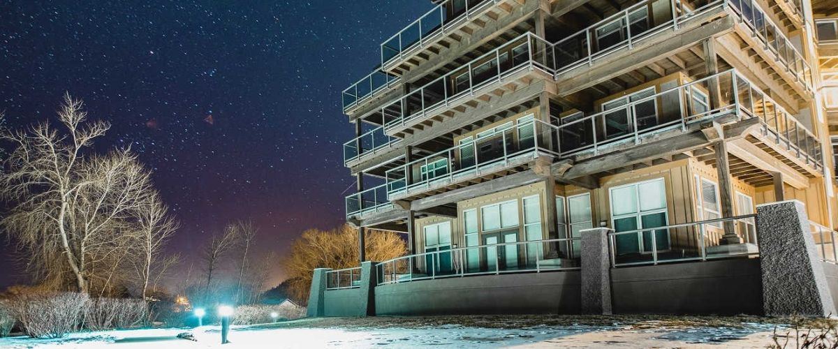
How high is 381 feet?
It is 115 feet taller than the tallest building in Kelowna.
It is also about a quarter the height needed for a falling person to reach terminal velocity.
If you fell from that height you would have five...
Smith Creek Trails
Duration/Distance: 15 km (various routes) /1-4 hours
Elevation Gain: 400-700 metres (depending on route taken)
Difficulty Level: moderate
Access Points: From Hwy 97 follow Elliott Road to Smith Creek Road. Turn right onto Smith Creek and follow it up. The road...
Kalamoir Splash | Run
Distance: 4.37km (2.71 mi)
Elevation Gain: 15m (low)
Route Design: out & back
Difficulty Level: easy
Access Points: End of Benedick Rd or reverse the route and start at the end of Sunnyside Rd
About this Run: From Casa Loma to the...
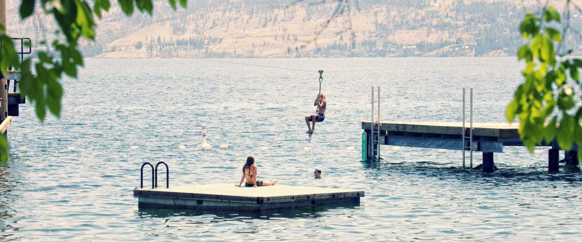
The Gellatly Bay Waterfront is the perfect place to spend a leisurely afternoon during the warm summer months. This video captures the fun that can be had - from bike rides to ziplining!
[embed]https://www.youtube.com/watch?v=E6xltggeEQA[/embed]...
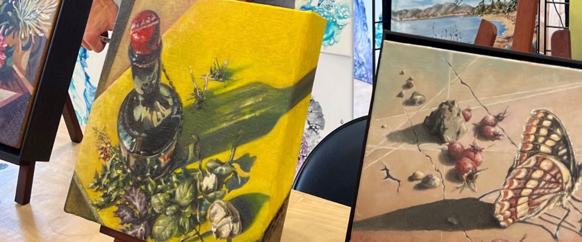
Studios & Galleries
Spend the afternoon taking in a self-guided tour of some of West Kelowna’s best art studios and galleries. Download a printed map or use our mobile friendly mapping system to chart your course! Our vineyards and orchards as...
The Westside Farm Loop, located in West Kelowna, is a collection of farms, fruit stands, markets, farm to table events and agricultural experiences.
The best way to discover the bounty of the land is to round up your friends, fill up...
GLEN CANYON REGIONAL PARK (NORTH)
Distance/Duration: various routes; over 4 km/2 hours or less
Elevation Gain: 70 metres
Difficulty Level: moderate to difficult
GPS: 49.835192, -119.647489 or 49.848037, -119.663503
Access Points: The Aberdeen Trailhead can be found at Aberdeen & Webber Roads. Go to the...
ROTARY TRAILS
Distance/Duration: 1 km/1 hour or less
Elevation Gain: minimal
Difficulty Level: easy to moderate (a few stairs)
GPS: 49.815579, -119.623165
Access Points: Gellatly Road, across from the Westbank Yacht Club.
About this Trail: You will find a network of trails and bridges that follow...
GLEN CANYON REGIONAL PARK (SOUTH)
Distance/Duration: 2.2 km one way/2.25 hours for the Glen Canyon Green Way Trail
Elevation Gain: 80 metres
Difficulty Level: moderate (stairs)
GPS: 49.825429, -119.642256 or 49.827054, -119.636830
Access Points: Three access points: The main parking area at the south end of...
SHANNON LAKE REGIONAL PARK
Distance/Duration: 2 km round trip/1 hour or less
Elevation Gain: 0 metres
Difficulty Level: easy
GPS: 49.855102, -119.617646
Access Points: Parking lot off of Shannon Lake Road
About this Hike: This is perfect for a leisurely stroll as there are wide flat...
TELEMARK TRAILS
Distance/Duration: various routes; 0.5 km – 15 km depending on trails chosen/1-6 hours
Elevation Gain: 0 – 200 m depending on trail
Difficulty Level: easy to difficult – depending on trail
GPS: 49.862117, -119.71033
Access Points: 9 km from Hwy 97 along Glenrosa...
POWERS CREEK MOUNTAIN BIKE TRAILS
Duration/Distance: various routes; 2 to 8 km
Elevation Gain: up to 600 metres
Difficulty Level: difficult
Access Points: From Hwy 97 turn onto Glenrosa Road. This is the same road that heads out towards Crystal Mountain. You will pass...
BEAR CREEK PROVINCIAL PARK HIKING TRAILS
Distance/Duration: various routes; Canyon Rim Trail 2.5 km/2 hrs – Loop Trail 15 minutes
Elevation Gain: 90 metres maximum
Difficulty Level: moderate – trail is well maintained
Note: There are stairs on some routes.
GPS: 49.927696, -119.512632
Access Points: Turn...
FINTRY PROVINCIAL PARK - WEST KELOWNA
Distance/Duration: Various routes, Shorts Creek Gorge Trail 2-3 km/1-2 hours
Elevation Gain: 40 metres
Difficulty Level: easy to difficult (400 stairs)
GPS: 50.140402, -119.501435
Access Points: Fintry Delta Road, off Westside Road, approximately 34 km north of the junction...
SMITH CREEK GRUEL - MOUNTAIN BIKE TRAIL - WEST KELOWNA
Duration/Distance: 15 km (various routes) /1-4 hours
Elevation Gain: 400-700 metres (depending on route taken)
Difficulty Level: moderate
GPS: 49.856237, -119.662584
Access Points: From Hwy 97 follow Elliott Road to Smith Creek Road. Turn right...
MCDOUGALL RIM TRAIL /HAYMAN LAKE
Distance/ Duration: 9 km round trip/4-6 hours
Elevation Gain: 700 metres
Difficulty Level: difficult
GPS: 49.884910, -119.587735
Access Points: From Hwy 97, turn onto Bartley Road and then left on Shannon Lake Road. On your right hand side a sign...
The trails in this area are looped and offer some beginner trails in the lower elevations with more challenging ones higher up. It is a great area to ride as there are flat cross country trails, single track trails along...
West Kelowna is home to Mt Boucherie, a dormant volcano that erupted over 50 million years ago. Because of this, there are several areas around the community that budding geologists can hope to see some volcanic explorations.
Mt Boucherie is the...
Visiting an orchard to pick some fresh fruit is a ‘must do’ when visiting West Kelowna. The red stained fingers from cherries or the warm juices of a peaches running down ones chin after the first bit, these are what...
Now that the snow has disappeared, for those with a little ‘spring fever’, we have some suggestions for you to participate in over this spring break. The top five things to do in West Kelowna on Spring break include:
Stopping...
The group of wineries that formed the Westside Wine Trail decided that they really like working together and are in it for the long term. This past week they announced that they have officially become an association and they held...
One of the latest buzzwords in agriculture is ‘Farm-to-Table’, but in West Kelowna it is more than the latest fad, it is a way of life. There are deep roots here with many of our orchardists being multi-generational farm-gate operators...
One of the most highly anticipated things about summer is the ripening of the fruit! Red juicy cherries, plump peaches and crisp apples are just a few of the fruits that are grown in West Kelowna. Depending on when you...
It is the time of year when the spring rains have washed away the winter blues and have brightened up our lawns and natural landscapes. But with the spring rain all the debris that was hidden away by the snow...
Be sure to mark Friday nights down on your calendar for July and August as the new ‘Music in the Park’ series begins. These FREE community concerts are hosted by the Parks, Recreation & Culture Department of the District of...
Passion and commitment could be felt among the attendees at the first annual Meet Your Maker Okanagan Conference that was held in West Kelowna on April 16th. Over 100 growers, producers, chefs and buyers from Osoyoos to Salmon Arm all...
There is excitement and anticipation in the air around West Kelowna these days and it is due to Saturday’s big announcement of ‘which community will be the next Kraft Hockeyville’. Organizers have a party planned and the community is invited...
Now that I have recovered from the decadence of the “Sip with Your Sweetheart” event that the Westside Wine Trail put on, it’s about time I write and post some pictures from the event. It was fantastic to see so...
Wine and chocolate are a match made in heaven, or at least according to the Westside Wine Trail group of wineries.
On February 12th, just in time for Valentine's Day, the wineries of the Westside Wine Trail will be holding a...
If you haven’t already taken advantage of the annual Wine & Dine program that the BC Restaurant & Foodservices Association is putting on in partnership with the BC Wine Institute, don’t worry, you still have a few days.
The program offers...
West Kelowna is Kraft Hockeyville! It has been very exciting each week to hear of a new community group or business who is stepping up to show everyone just how enthusiastic we all are about hockey in our community. In...
It is a great weekend to come for a visit to West Kelowna as Winterfest kicks off this weekend.
Saturday will see the annual light up of the West Kelowna Firehall #31 and all the festivities that surround it. From 5:00 pm - 6:00...


Recent Comments